Map
LesCaS offers a set of tools for user to configure the map. There are three types of map features which can be accessed in LesCaS.
Map Navigation
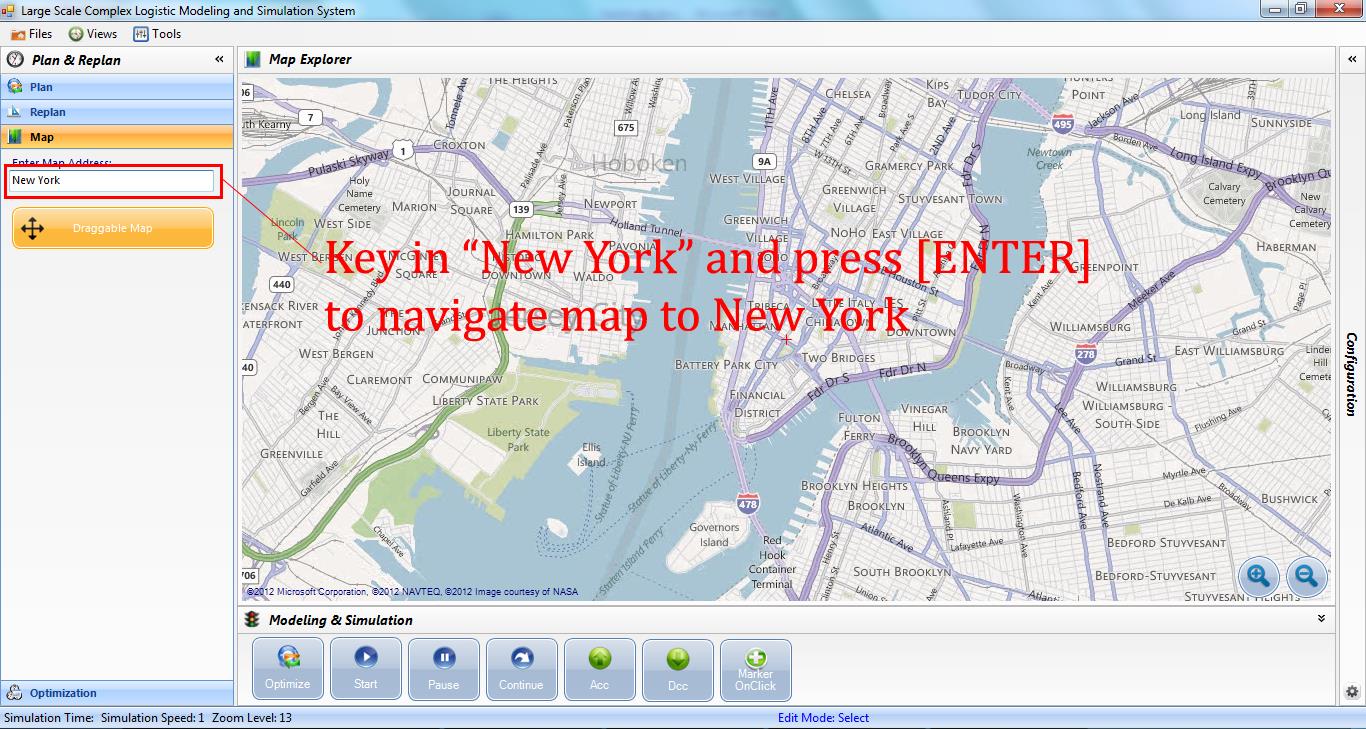
The map navigation feature can be found in the Map panel under the Plan & Replan panel set on the left side of LesCaS GUI. In the Map panel, The Enter Map Address feature allows user to go anywhere on the map by simply entering the address of the location.
The second feature Draggable Map in the Map panel is a toggle button which when toggled ON, allows user to hold down left mouse button and drag the map; when toggled OFF, user can only move the mouse cursor around a static map.
Another related navigation feature is the ability to show the address for any geo point on the map. To turn on this feature, uncheck the menu item Views → Map → Net Reduce Mode.

Map Configuration
Map configuration features allow user to change the source and loading process of the map in LesCaS. These features are located in the Map Configuration panel of the Configuration panel. The display of the latitude and longitude of the current center of the map automatically sync with the map when the map is dragged by the user.
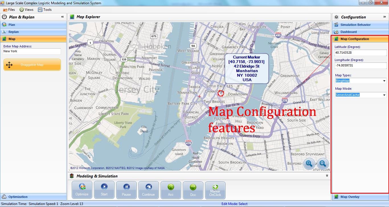
There are Map Source and Storage Mode features which display the current map type and current map mode respectively. Map Source allows user to configure LesCaS to use various types of map, such as traffic, satellite, etc. Source Mode allows user to configure LesCaS to retrieve and store map in different ways.
- Server option - map is retrieved from server and is not stored locally
- Cache option - map is retrieved locally
- ServerAndCache - map is retrieved either locally when available or from server and is stored locally after retrieved

Map Overlay
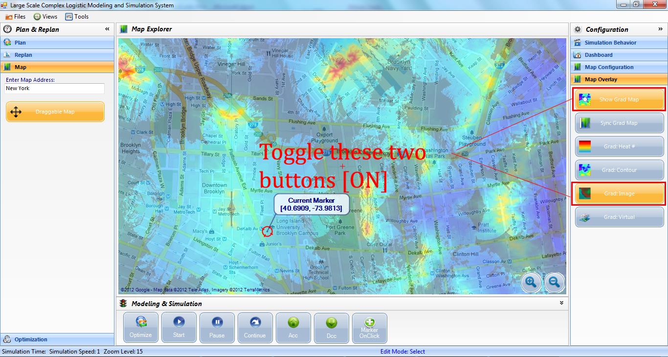
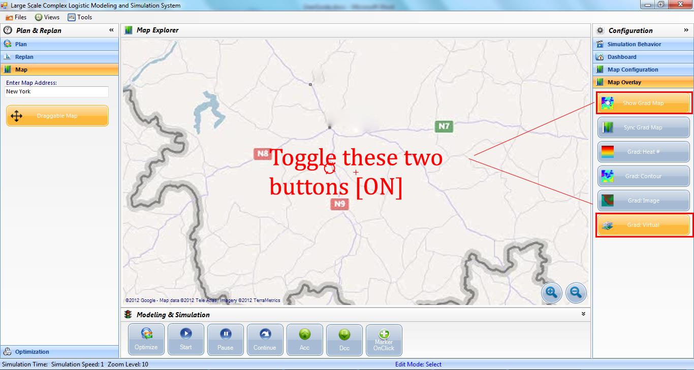
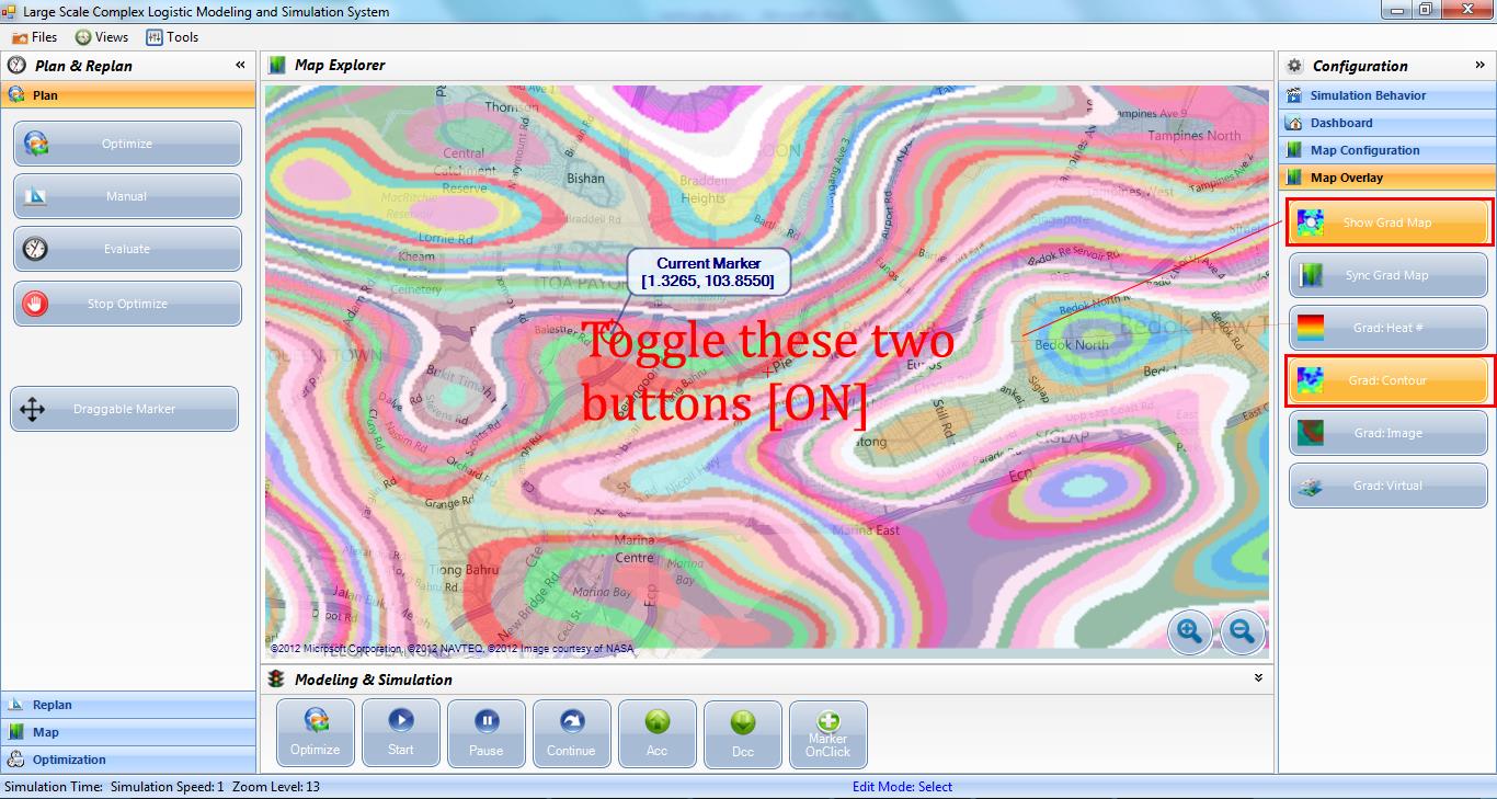
Map overlay features add customized map layers on top of the map. These can be found in the Map Overlay panel of the Configuration panel set. By using features in Map Overlay panel, user can create a virtual map or a gradient map on top of the actual map. The Show Grad Map toggle button allows user to switch between the gradient/virtual map and the actual map.
- Grad: Image - attach a gradient map on top of the actual map
- Grad: Virtual - create a layer of virtual map on which map annotations are displayed. LesCaS is capable of hiding out any location specific information such as actual address and earth location from the virtual map annotation.
- Grad: Contour and Grad: Heat - generate contour map and color heat height map using Perlin Noise algorithm respectively